12th February 2020
By Ellie Pryor
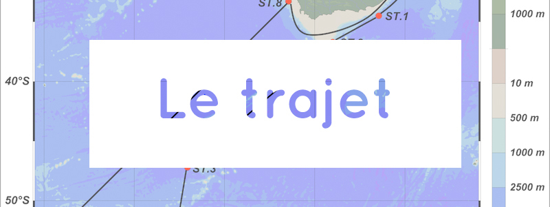
We are currently at 39°S cruising towards Site 3 which is situated near to IODP 1088. We were unable to core Site 1 or 2 so are all hopeful for Site 3 and have our fingers crossed! Sites 1 and 2 are situated under the influence of the strongest Western Boundary Current in the world- the Agulhas Current. Marine sediments are valuable archives for reconstructing past climate and ocean variability, therefore it is important to select the appropriate site for coring.
Before coring we carry out a Pre-Site Survey which helps generate images of the sea floor using Bathymetric surveys and Multi-beam Sonars and allows us to select the best location for collecting a sediment core. These surveys are necessary in order to find the safest location for the coring as we do not want to drill into hard rock and break the instruments. Also finding an area with a high sedimentation rate is advantageous for studying sediment cores extending further back in time, therefore avoiding gulleys and canyons which have likely been infilled with newer sediments rapidly is key. However, there are some limitations with multi beam bathymetry such as interference which is noise from unwanted sources. We also saw artefacts and multiples in the images from refractions, both of which make interpretation difficult and add to the struggle of finding the perfect site.
Acoustic Doppler Current Profilers (ADCP) are used to measure the water velocity. These Bathymetric Surveys are carried out to measure the depth of the water as well as mapping the underwater features. This is performed through transmitting sound waves which reflect off the sediment and other objects in the water column.
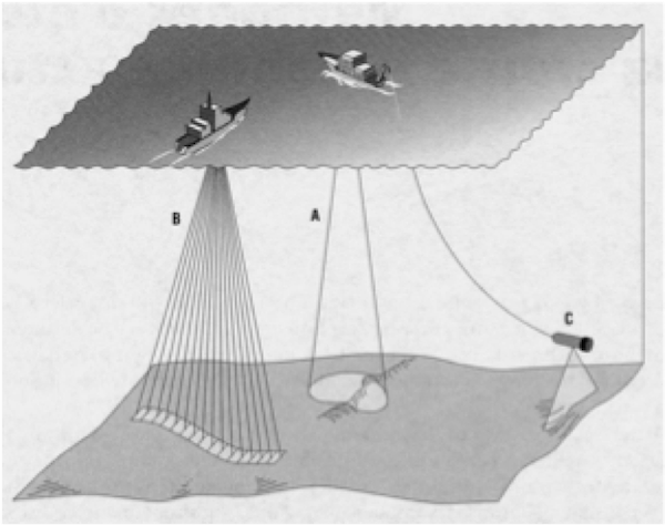
Geophysical Imaging Techniques of the seafloor
Multi- beams can help us accurately visualise the ocean floor, they images are high resolution, 3D and show the topography beneath us. Multi beam echo-sounders send out beams which are bounced back from the seafloor, generating real time data which provide profiles of the sediment deposition patterns and accurately represent the structure of the sediment, i.e. the layers and nature of deposition.
Lastly there are sub bottom profilers, a transducer sends out a sound wave which can penetrate the seafloor, providing images of the layers of sediment beneath the water column.